|
IJsselstein to Montfoort and back
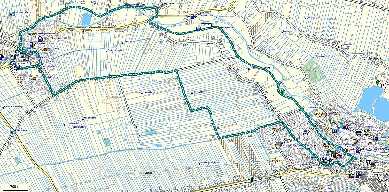
| The track projected on the TopoNL map of the area. Wer started and ended the walk in the bootom right, along the northern route, following the Hollansche IJssel, to Montfoort in the top left corner, and returned along the southern route, following old dykes and boundaries between Holland and Utrecht. |
 |
| Total images: 39 | Last update: 09-May-2009 21:23 | Help |