|
Voerstreek
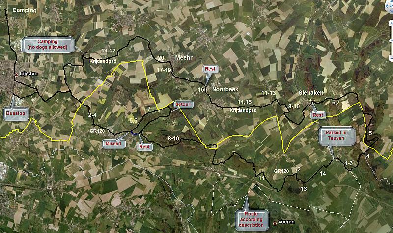
| The full route projected in GoogleEarth, showing where the images were taken (approximatly). Both days start by 1... | Google.png | 1348x801px | 1.6MB |
 |
| Total images: 2 | Last update: 20-Oct-2009 09:31 | Help |
|
| The full route projected in GoogleEarth, showing where the images were taken (approximatly). Both days start by 1... | Google.png | 1348x801px | 1.6MB |
|
|
| Total images: 2 | Last update: 20-Oct-2009 09:31 | Help |