This is the second part of the very long part of this path, between IJsselstijn and Ouderkerk aan de IJssel, all together over 40 kilometers, and we did the first part last year: from IJsseltein to Vlist. Today we took the second part, from Vlist to Ouderkerk. We parked the bikes in Ouderkerk, drove on to Vlist along one-track willow lanes, and walked back. Then took our bikes and headed over the same narrow roads back to Vlist.
Anticipated to be about 22 kilometers, it turned out to be come 26, due to the fact the route has been altered. Where the description pointed out straight on, the current routing lead us straight into Stolwijk, and from there we could have gone straight on, as signposted. However. we decided to keep to the book and found the path mentioned to be “No access”. We went on to find an alternative but in the end, we had to take the forbidden path. No trouble at all, and at the end, we saw the route was indeed diverted into Stolwijk. You may have luck, as well, as long as you shut the gate when closed.
These searches meant a few kilometers extra.
Though it looks like walking back from a dead end, the longer ‘spike’ at the end is not: Walking down the quai to get to a bridge to cross the waters and than walk back over a cycle path. The only way to get to the other side.
As you well see, we were walking towards the city area of Rotterdam. Just a few kilometers away from this metropole, there are thes low lands – with lots of open space, birds and cattle.
Below sea level, this is the area of flat, open, low lands, no more than a feet above water surface. No wonder that some houses lean over to one side. Sometimes walls crack, but some houses don’t show any damage at all. Just leaning over.
Spring is the time of nesting birds, and we found a few. Ever seen a duck’s nest, on eye-height in a willow tree? We’re still wondering how she got in there. If it weren’t for her white breast, we may not have noticed… Another duck kept closer to the ground but hide herself – in a willow trunk, inside the new stems.
Other birds nests are surrounded by water, save by nature for cats and foxes. And after hatching, the little ones are cute.
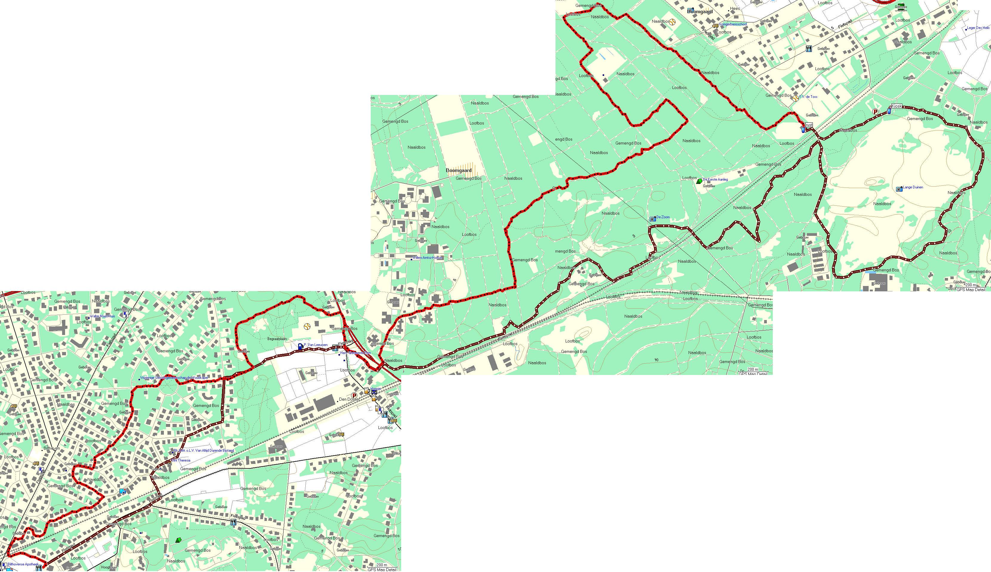
I took some images on this walk, and the tracks are here in Garmin, general and CSV formats. You won’t find a bigger map, since the whole route is decribed in a LAW booklet, and is fully signposted by yellow-and-red markers.