It’s an easy walk, about 15 kilometers: From home to a shop in Woudenberg to get wheat and flour for bread and cake. It is a fine day – not too warm, so I made this walk along the Valleikanaal, collected what I came for, and returned along the old railroad track.
Just images, no track: getting lost is too difficult on this one 🙂
Tag: Leusden
Around Leusden (3)
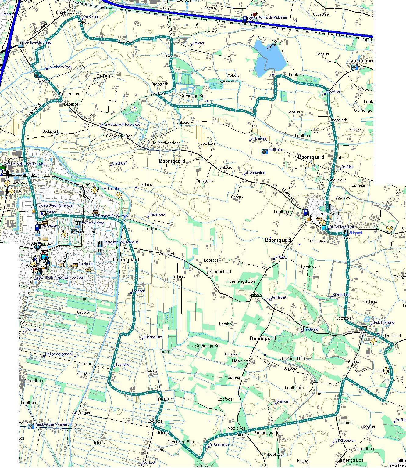
By bike, this time, but the same route can easily be walked – it’s about 25 kilometers. Not all roads are smooth. Some are no-paved, or in bad shape!
A new cycle path has been opened and we wanted to find out where it would lead us. A bit of a suprise, or disappointment, it turned out to be another route to Hoevelaken, at end, we went back to Stoutenburg and followed a path we walked some time ago. At that time, it meant finding our way over roots, but the path has been ‘upgraded’ to cycle track. At the end, we turned left in stead of right and took a longer route to Achterveld, from there over De Glind, in the direction of Scherpenzeel but bent back to Leusden – and because it was nice weather, it was foreseen the route along the canal would be crowded so we kept to the road.
On the map, start and finish are located in Achterveld, near the church. There are a few bars there, that can be used as a starting point.
You’ll find track (map and Google projection) , and tracks in Garmin, GPX and CSV format. No images this time, but you can get the map here
Around Leusden (2)
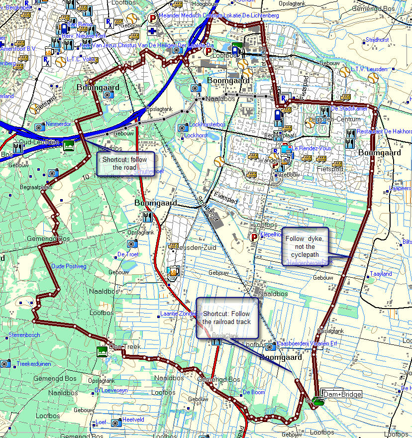
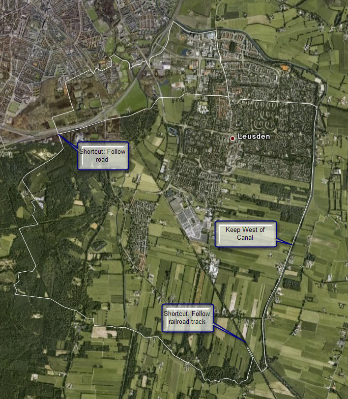
One of the inevitable routes follows the dike aside the Valleikanaal. If you keep the high grounds on the westside,you’ll be able to get off the dyje over a narrow footbridge to the old railroad track. Either follow that track – partly over the old track, partly on the road aside it. Or get off at the first opening, turn left and follow the forest track. There are several ways to continue, one is following the long distance patyh of the Utrecht Pad through the woods of Den Treek. At end, you can cross the highway into amersfoort and find your way to the station (and contiue the Marskramerpas to Leusden), or follow the road aside the highway.
This is the map of this walk, and it’s projection on GoogleEarth – and the Garmin, GPX and CSV fomat tracks.
Around Leusden (1)
Last year, we walked from home to Achterveld – a village in the same parish – following smaller roads and a path along a stream. Back, we followed the normal road except for one detour, where we used a farmer’s road. All in all, the walk ia about 20 kilometers, and in wet conditions, the path along the stream can be very muddy and slippery. Waterproof and well profiles shoes are recommended.
The images can be found here. There are no other resources (at the moment)