
Track of today on the map
Track of today.

Track of today in satellite terrain
The track projected in the terrain, showing (more or less) where the images were taken.

Monument on the story of "Kalla's Tower" - commemorating Kalla's (Caligula) visit, positioning his soldiers and catapults on the beach, claiming victory over the sea and ordering his men to collect shells as spoils of war (source https://nl.wikipedia.org/wiki/Brittenburg)...

...The "fortress" in the middle is a presentation of the fortress "Brittenburg" - Lugdunum Batavorum - that was located several hundreds of meters off the current coast. Most likely it was nothing more than a storage for cerials. (source https://nl.wikipedia.org/wiki/Brittenburg)

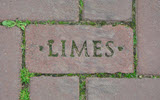
From this monument, looking to the West, the mouth of the Rhine river, and the end of the Limes in the Netherlands.

Viewing the rsetaurants on the beach, against the skyline of The Hague

Ships waiting to enter the port of Europoort (West of Rotterdam) - mainly tankers as floating reservoirs

Wild flowers in the dunes

The fisherman's church in Katwijk (which is a fisherman's village by origin)

Statue of painters - Katwijk aan Zee attreacted many painters because of the beach - and the fishing boats, at that time mored on the beach

Andreashof - I guess kind of almshouses...

.. behind the Andreas church, one of the focal points of the boulevard

Dunes beyond Katwijk: Vlaggeduin area

path through the area: Since dunes are actually the defense against high tides, all precations are taken to prevent loss

Fowering rising plant

Shrubs
Roses and sea buckthorn

Rose
Dunne-rose flower

Bushes and mosses - and some grasses

Entering the city again (quarter of Zanderij)

Old Rhine arm - now a creek in a park


