
Track of today on the map
Track of today.

Track of today in satellite
The track projected in the terrain, showing (more or less) where the images were taken.

Farm at the crossing

Lake in the woods - former claypit

Another former claypit - with the stone

Shadow walks with us

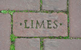
At the entrance route to the brick factory

Former brick factory buildings behind trees

"Eiland van Maurik" recreational area ...

... with the movable weir in the river

Geese in the outlands

It is a huge area...

Geese and cattle

Farmhouse, build to withstand flooding - quite common in autumn and sping

Tha lands of the farm

Mill of Maurik

This is, historically, THE area for fruit growing: plantages within wind-breaking hedges, parallel to the lines of trees ...

... and on the short end

Geese time

Route to a ferry for pedestrians and cyclists - but not in winter


