HOME  »  Holidays 2008 » 14-Jun  (49 Slides)     [Page 1 of 3] :: $text.jump-to  
  You have reached the first page You have reached the first page      Up one level      Next page Last page Help

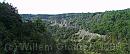
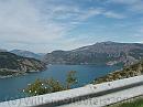
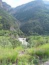
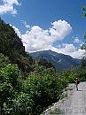
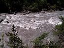
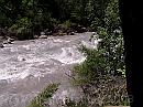
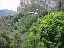
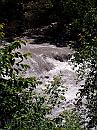
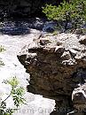
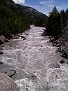
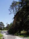
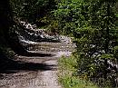
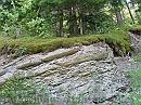
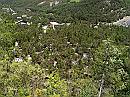
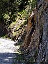
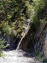
Today we moved from Les Bernards to the camping site from where we could do the GR56: Camping RioClar, 1.5 kilometers from La Fresquiere, between Meoland and Barcelonette. We took the road following the Lac de Serre-Poncon and then kept in the Ubaye valley - spectacular at times. At the camping site, the receptionist (Annelies, be Belgian girl that found a new life here) contacted the huts - and soon we learned it was not feasable to do our intended walk, due to snowfields and landslides, that required special gear to cross. Gear we dind't have. So we had to change out plans. Annelies supplied us with 19 (!) walks in the neighbourhood that we could do instead, without risking getting stuck halfway. So we started out with a first walk to Barcelonette, first back to Meolans to cross the river, and then on the Southern side to Barcelonette, and along the road back. We were told it was about 8 kilometers, but it was closer to 10...

03-DemoisellesCoiffees * Underway, opposite out appartment, are these weathered rocks called Ladies with the Hats, that rise above the road. * 2949 x 1239 * (401KB)
04-Sheep1 * A shepard leading sheep through the village named Le Sauze di Lac * 2380 x 1148 * (225KB)
05-Dam * A look toeards the dam, just past the village of Le Sauze di Lac * 3072 x 2304 * (527KB)
06-SouthBank * Clot la Cime (just a few meters short of 1500 m) * 3072 x 2304 * (373KB)
07-Ubaye * The Ubaye river, we were to follow towards the next campingsite - and the narrow valley we had to pass. * 2304 x 3072 * (1.29MB)
  03-DemoisellesCoiffees  
  04-Sheep1  
  05-Dam  
  06-SouthBank  
  07-Ubaye  
08-Meolan * From the camping site to Meoland where we could cross the river, a small tower peeks out of the woods * 2304 x 3072 * (955KB)
08-Ubaye-1 * The Ubaye river aside the road - wild water all the way. Kayaking was forbidden: too much risk. This image shows why * 1984 x 1488 * (553KB)
09-Ubaye-2 * Rocks are hidden below the surface, and soem were actually crashed agaist them and drowned. * 1984 x 1488 * (583KB)
09a-Church * The church of Meolan * 3072 x 2304 * (1.15MB)
10-Ubaye-3 * Another viw of the wild river, where rafting would be a challenge. It has all the ingredients of a thrilling ride * 1488 x 1984 * (637KB)
  08-Meolan  
  08-Ubaye-1  
  09-Ubaye-2  
  09a-Church  
  10-Ubaye-3  
11-Rock * A singe rock that peeks over the stream - and holds a small tree * 1488 x 1984 * (561KB)
12-UnderBridge * Ubaye river seen from the bridge. * 1488 x 1984 * (529KB)
13-WildRose * Wild roses along the track * 1488 x 1984 * (469KB)
14-JustStanding * A high cliff, where a tree is halfway of falling off * 1488 x 1984 * (540KB)
15-TemporaryFord * A temporary ford - no way the water of a downhill stream could keep to the intended bed, so if flows straight over the road. * 1984 x 1488 * (642KB)
  11-Rock  
  12-UnderBridge  
  13-WildRose  
  14-JustStanding  
  15-TemporaryFord  
15a-Moss * Moss over a pile of rock * 3072 x 2304 * (1.39MB)
16-RioClar * The camping site from the opposite border; We pitched somehere near the middle at  the right edge * 1984 x 1488 * (756KB)
17-Ubaye-Wide * Looking upstream, it shows meanders of the river; each branch does carry part of the stream, but it must have been much wetter * 1984 x 1488 * (610KB)
18-AllWater * From every mountain-side rock, water falls, flows or drips down. * 1488 x 1984 * (647KB)
19-LargeFall * A larger waterfall, that disappears in a dug hole aside the road * 1488 x 1984 * (693KB)
  15a-Moss  
  16-RioClar  
  17-Ubaye-Wide  
  18-AllWater  
  19-LargeFall  
$text.updated-on 12-Sep-2008 23:28
(c) 2008 Willem Grooters, Rita ter Steege