HOME  »  Holidays 2008 » 19-Jun  (45 Slides)     [Page 1 of 3] :: $text.jump-to  
  You have reached the first page You have reached the first page      Up one level      Next page Last page Help

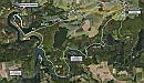
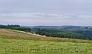
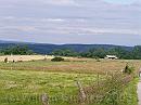
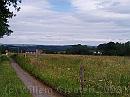
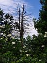
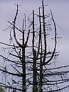
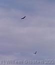
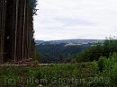
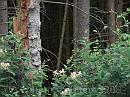
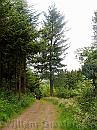
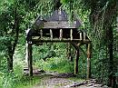
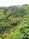
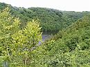
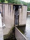
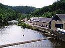
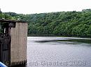
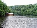
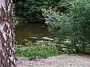
There are two rivers named Ourthe - The Eastern (Ourthe Oriental) and Western (Outhe Occidental); close from where these two meetm a dam is build to control the flow downstream (to prevent flooding and damage) and produce electricity. Today's wal lead us from Grande Mormont. over the rolling hills to Filkly and from there to the confluence of the two rivers, with a sidestep to the Barrage de Nisramont, over a ridge bove the forest. The way to this ridge was mainly over the rolling hills, but the way back followed the Ourthe Oriental back to our starting point.

Google * Our route, the numbers pointing the location where these photographs were taken (well, somewhere near these positions) * 1058 x 616 * (172KB)
01-FriendlyViews * The hills East of Grande Mormont, heading to Filly, looking out over the Western, lower hills. * 1978 x 1179 * (252KB)
02-Farmlands * Another view over the farmland * 1984 x 1488 * (433KB)
03-WideViews * The path along the meadows * 1984 x 1488 * (444KB)
04-DeadTree * A dead fir spreads it's brances like a thorny candlestick * 1488 x 1984 * (561KB)
  Google  
  01-FriendlyViews  
  02-Farmlands  
  03-WideViews  
  04-DeadTree  
05-DeadTreeTop * Or is it a cry for help, or mercy? or joy? * 1488 x 1984 * (427KB)
06-AirBattle * A buzzerd is being chased by a crow * 1122 x 1320 * (65KB)
07-ForestWall * Edge of the foreest: It's partly felled, now showing the straight stems * 1984 x 1488 * (334KB)
08-Honeysuckle * Honeysucke against the darkness of the woods * 3072 x 2304 * (1.09MB)
09-FreeStanding * One tree stabds aside - reaching high * 1488 x 1984 * (587KB)
  05-DeadTreeTop  
  06-AirBattle  
  07-ForestWall  
  08-Honeysuckle  
  09-FreeStanding  
10-Shed * On the begiining of the ridgeway, there is this shelter, so low you have to bend to get through. * 1984 x 1488 * (650KB)
11-GlimpseOfTheRiver * A glimpse of the Outrhe Occidental down the ridge * 1488 x 1984 * (623KB)
12-Canoeing * The lake in front. The river (and the lake) are used for canoeing. * 1984 x 1488 * (630KB)
13-SlidingDoor * On top of the dam, the water is at it's highest possible point, The top can be hoisted to let a surplus of water out. * 1488 x 1984 * (495KB)
14-WatchBird * Know you're being watched * 1266 x 999 * (203KB)
  10-Shed  
  11-GlimpseOfTheRiver  
  12-Canoeing  
  13-SlidingDoor  
  14-WatchBird  
15-TheMill * The lower dam and the power plant. just right after the ridge are the two outlets. * 1984 x 1488 * (498KB)
16-Outrhe * Lac de Nisramont seen from the dam * 1984 x 1488 * (552KB)
17-Lakeview * A boat house on the lake. * 1984 x 1488 * (663KB)
18-DamAndBuildings * getting down, and looking along the power plant, it shows the dam is not very high. The amount of electricity isn't very high... * 1650 x 702 * (214KB)
19-AlongTheRiver * Water plants up the river * 1984 x 1488 * (663KB)
  15-TheMill  
  16-Outrhe  
  17-Lakeview  
  18-DamAndBuildings  
  19-AlongTheRiver  
$text.updated-on 12-Sep-2008 23:33
(c) 2008 Willem Grooters, Rita ter Steege