|
Rondom Amersfoort - first two walks
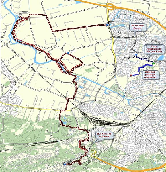
| This maps our walk, including the transferby bus from, and to the registration center - and the extra walks between parking and the busstop. The red dotted lines mark portions that were opened for public access for this particular occasion only - normally, these areas are closed, even for walkers. | MapSource.jpg | 1222x1266px | 412kB |
 |
| Total images: 2 | Last update: 11-Oct-2009 20:29 | Help |