|
Pieterpad-Zuid: Swolgen-Venlo
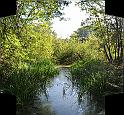
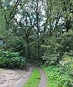
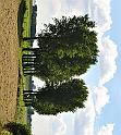
| Starting at the church of Swolgen, today's route followed old riverbeds towards the Maas at Grubbenvorts; crossing the river by ferry, the route than follows the Eastern bank, through wastelands, flooded on high water. Ending at the station in Venlo, we took a bus back to Swolgen, and drove to a camping site wets of Venlo to spend the night. |
|
|
|
|
| |||||
|
|
|
|
| |||||
|
|
|
|
| |||||
|
|
|
|
| |||||
|
|
|
|
| |||||
|
|
|
|
| |||||
|
|
|
|
| |||||
|
|
|
|
| |||||
|
|
|
|
| |||||
|
|
|
|
| |||||
|
|
|
|
| |||||
|
|
|
|
| |||||
|
|
|
|
| |||||
|
|
|
|
| |||||
|
|
|
|
|
| 75 Images | Made with JAlbum & Chameleon | Help |


