HOME  »  Rheinsteig - Goarshausen - Wiesbaden » 02-09  (21 Slides)     [Page 1 of 2] :: $text.jump-to  
  You have reached the first page You have reached the first page      Up one level      Next page Last page Help

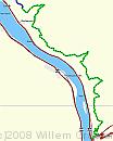
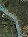
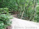
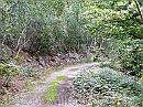
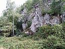
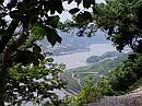
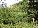
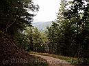
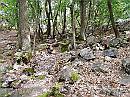
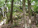
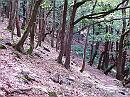
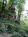
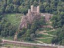
Day three - a rather short walk, from the camping site to Assmannshausen. The camping site is somewhat off-route, it means getting back uphill, a long ascend, not steep except for the last ten meters. For the rest, rather flat and mainly between vineyards - quite some of them abandoned: too costly to farm on these hills.

Track * A short walk today: From the camping site to Assmannshausen. We parked our bikes there, drove back to the camping site and started walking. It's a steep ascend to get back to the route but once up there, the route was rather flat; it runs along an old quartzite quarry, with some turns. * 673 x 841 * (52KB)
Google-0902 * Not so many images, as you can se on the projection. Most of the route is through vineyards, except for the first part that runs through woodland. * 686 x 892 * (235KB)
01-Curves-Bodental * The bends getting out of the Bodental. * 1984 x 1488 * (651KB)
02-Quartsite * Along the quarry site - where unusable material is just spilled down the slopes. * 1984 x 1488 * (736KB)
03-AlongQuarry * The road once used by the quarry people. Larges blocks of rock on either side, or even bigger chunks of stone on the wooded slopes on the left. * 1984 x 1488 * (740KB)
  Track  
  Google-0902  
  01-Curves-Bodental  
  02-Quartsite  
  03-AlongQuarry  
04-Teufelskadrich * The forefront of an old quarry - most of the stone used in local building. * 1984 x 1488 * (709KB)
05-Window-Trechtingshausen * A window in the woods. * 1984 x 1488 * (544KB)
06-Woodland * Woodland over the Rhine; once, this has been covered with grapes. * 1984 x 1488 * (661KB)
07-Eisenkaut * The bend near Eisenkaut, an old mine hidden in the sloes on the left side. The place is marked, and hard to get at, because the slopes are steep. * 1984 x 1488 * (566KB)
08-StoneMen * But proof is there; and people had piled stones to form stone men - a lot of them. * 1984 x 1488 * (748KB)
  04-Teufelskadrich  
  05-Window-Trechtingshausen  
  06-Woodland  
  07-Eisenkaut  
  08-StoneMen  
09-BachacherKopf * The 'peak' named Bacharacher Kopf. Though the village with that name lies on the opposite bank of the Rhine, and kilometres more north. * 1984 x 1488 * (714KB)
10-Slope * The path traverses a steep slope, returning to the river * 1984 x 1488 * (666KB)
12-RocksToScale * and bends passed a upright pile of rock - steep slopes all around * 1488 x 1984 * (685KB)
13-BurgRheinstein * But passed that point, there is this view of Burg Rheinstein. The zigzag road leads to a tunnel under both the railroad and highway to a parking place on the riverbank. * 1984 x 1488 * (561KB)
14-Copula * High above Assmannshausen, there is this copula - with copper roof - looking out over the place and the river. * 1984 x 1488 * (564KB)
  09-BachacherKopf  
  10-Slope  
  12-RocksToScale  
  13-BurgRheinstein  
  14-Copula  
$text.updated-on 23-Oct-2008 23:04
(c) 2008 Willem Grooters