HOME  »  Trekvogelpad - Maarn-Ede » 7-Jan-2008: Rhenen-Ede  (22 Slides)     [Page 1 of 2] :: Jump To  
  You have reached the first page You have reached the first page      Up one level      Next page Last page Help

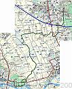
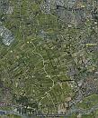
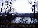
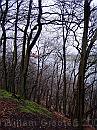
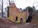
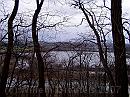
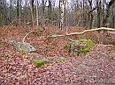
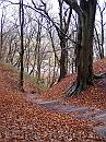
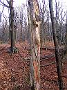
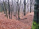
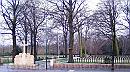
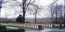
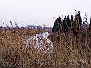
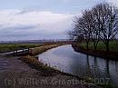
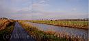
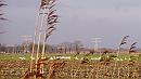
Starting at the trainstation of Rhenen - at the verges of the Utrechtse Heuvelrug, we passed the high lands of the Grebbeberg, along the steep slopes that fall down the the Rhine. This area has been the site of heavy fighting in May 1940, the beginning of the Second Worldwar, and operation Market Garden wasnt far from this location either. From here, we followed a stream called Grift that eventually ends in the avlleikanaal that surrounds our village. But we took a slightly different direction to Ede

00-Mapsource * Starting at the train station in Rhenen, walked over the Grebbeberg, along the Grift to the trainstation Ede-Wageningen, return by bus. Only tha last part we had to walk in rain. For some reason, the start wasn't tracked properly but knowing we kept close to the slope, it's easy to reproduce. * 1194 x 1455 * (561KB)
google * The track projected on Google. After the last picture, I ran out of power for the camera... * 775 x 923 * (159KB)
01-Rhenen * An old clay pit, now nature reserve, with Rhenen on the other side * 1984 x 1488 * (517KB)
02-Uitzicht * Looking high over the rtiver Rhine - eastward * 1488 x 1984 * (691KB)
03-Walburcht * Ruin of an old burrough. * 1984 x 1488 * (565KB)
  00-Mapsource  
  google  
  01-Rhenen  
  02-Uitzicht  
  03-Walburcht  
04-BlauweKamer * Overlooking the nature reserve named De Blauwe Kamer * 1984 x 1488 * (563KB)
05-Bunker * This area observerd fierce fights in May 1940, this is one of the many reemains of bunkers and other remains of the fortress. * 1984 x 1488 * (723KB)
06-Trap * Stairs leading down - 40 meters or more. * 1488 x 1984 * (751KB)
07-Twisted * Twisted tree. * 1488 x 1984 * (611KB)
08-Dal * One of the gullies leading down to the Rhine. * 1984 x 1488 * (635KB)
  04-BlauweKamer  
  05-Bunker  
  06-Trap  
  07-Twisted  
  08-Dal  
09-Ereveld * War cemetary, about 400 casualties are buried here. Most of them died in May 1940. * 1981 x 1101 * (604KB)
10-Inhetgelid * Like soldiers: straight in line - even in death * 1896 x 934 * (418KB)
11-Grift * Grift - leading into the Gelderse Vallei. * 1984 x 1488 * (475KB)
12-Grebbeberg * Grebbenberg as seen from northeast * 1981 x 726 * (90KB)
13-Bocht * The Grift beds it;s way into the valley * 1984 x 1488 * (383KB)
  09-Ereveld  
  10-Inhetgelid  
  11-Grift  
  12-Grebbeberg  
  13-Bocht  
14-Vallei * Wide opan landscape, north. Left (West) is the Utrechtese Heuvelrug, on the right - furher away in the Eastm, is the Veluwe * 3615 x 1310 * (319KB)
15-Vallei * Another image of the wideness of the landscape. * 4840 x 1375 * (616KB)
16-Grift * Dug in the 1930's the Grift heads straight North * 3096 x 1464 * (431KB)
16-Zwanen * Swan feeding in the meadows. * 1749 x 987 * (180KB)
17-Eendengat * One side-kick - a former decoy. * 1984 x 880 * (110KB)
  14-Vallei  
  15-Vallei  
  16-Grift  
  16-Zwanen  
  17-Eendengat  
Album last updated on 22-Jan-2008 20:23
(c) 2007 Willem Grooters