A walk in an area rather close: 25 kilometers between De Bilt (Near the town of Utrecht) and Hollandsche Rading, on the boundary of the provinces of Utrecht and Noord-Holland. We had walked here before, but that route went East, to Den Dolder. We’ve been at Hollansdsche Rading as well, walking the Western part of the Marskramerpad (from Amersfoort to The Hague), and when following the Utrechtpad we had done some of parts of this walk as well.
But most of today’s walk – in cold, but sunny weather – was new. The walk follows the structure of the landscape: where waterways run SouthWest – NorthEast and meadows are rather narrow but stretch hunderds of meters in length, which is typical for the western part of the province. At Hollandsche Rading, the Noord-Holland area of Gooi, with it’s woods, marks the northern boundary of the low lands; And our way back followed the somewhat higher lands – drier and wooded; being the location of estates and manors – noblemen and riches – , in stead of farms and peasants.
I took some images for an impression, and, as usual, the tracking data is available in Garmin, general and CSV formats.
Tag: Utrecht
More near Leusden
Two tours near Leusden:
A cycletour of approximately 30 kilometers, riding from Leusden, via Stoutenburg and Hoevelaken to Terschuur, from there riding towards Barneveld, but changing direction towards De Glind – having a break at a newly openend restaurant – back to Leusden.
A walk to restaurant De Spitsheuvel – still closed when we got there – through to woods South of the highway, passing Kamp Amersfoort – a second worldwar remainder and commemoration site – to the border of thew Zon en Schild hospital; Back along the North side of the highway, over the belgenMonument – a monument commemorating the help given to belgian refugees during the First Worldwar, and Amersfoort woods and city outskirts.
There are no images, I only tracked both tours.
IJsselstein – Montfoort and back
A nice day in April – and rather warm as well. The IJsselstein Walkers Association has scheduled a walk to Montfoort and back. Parts of this route has been walked before – being part of the walk around Utrecht that we did finish some time ago. But this was in another season and that means a different view of the landscape: spawning and flowering trees, and many birds in the meadows.
These are the impressions of this walk, and the tracks are available – as usual in Garmin, general and CSV format.
LinschotenLoop
It seems to be a tradition, we found out afterwards: Saturday before Christmas a run is held in this little town, over distances of 2, 10 and 21.2 kilometers. Indeed: Half a marathon. For those that do not want to run, the same distances can be walked; That is: 5, 10 and, indeed, 21.2 kilometers.
The first part leads from Linschoten along the river called “Lange Linschoten” to Oudewater, another old small city, and from there along dykes and polder roads – all straight on – back to Woerden, where the Lange Linschoten was reached again, and that was followed into Linschoten.
The first part has been covered before: in one of the legs of the UtrechtPad, but in the opposite direction.
I took some pictures along the way, and the track is available in Garmin, general, and Comma-separated formats.
Villas and woods
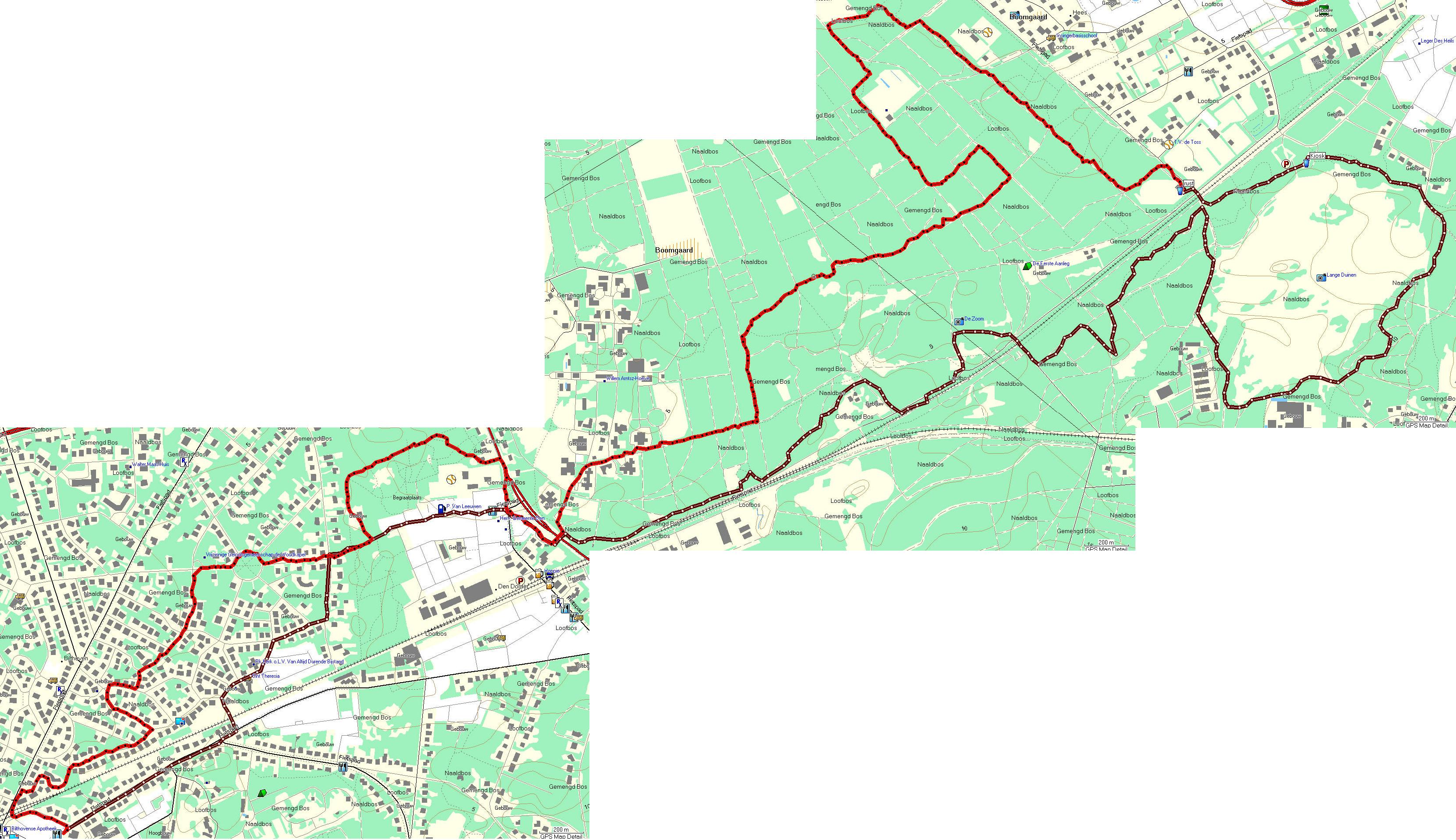
We made a 25 kilometer roundwalk today. Started in Bilthoven, near a shopping center, close to the railway station. There is little room for parking but we were very early this time, so we did find a place nearby. The route started along the road, crossed the railway and continued in an area where The Rich may live: big houses, big gates and big cars…In Den Dolder, we entered the woodlands – that covers a big part of the Utrechtse Heuvelrug, even in this middle, rather densely populated area. We circumvented the Soesterduinen – an area of drift sand, where dogs are allowed to run free – we come there now and than to let our dog run. We had our rest at the cantine of the Atletics club, after 12.5 kilometers. From there, the route continued over upaved forest roads and narrow tracks, back to the populated area. The final part went once more along the big houses on Den Dolder and Bitlhoven, back to the shopping center.
I took a few pictures in the woods. You can download the map, and the tracks in Garmin, GPX and CSV format.
Groenekan-Den Dolder, vice versa
We walked from the parking place near the sporting facilities west of De Bilt (also known as “Groenkan”) to Den Dolder, partly through woodland, partly through inhabited areas – big houses. The whole route was said to be about 25 kilometers but in fact it turned out to be about 20 all together. Most of the way back, my GPS lost signal so I had to reconstruct the track on the computer. These are the tracks in Garmin, GPX and CSV format – and these are maps and the few pictures I took.