HOME  »  Rheinsteig - Goarshausen - Wiesbaden » 01-09  (40 Slides)     [Page 1 of 3] :: $text.jump-to  
  You have reached the first page You have reached the first page      Up one level      Next page Last page Help

Second, started in Kaub, steeply uphill, and again, once out of the valley, the walk was fairly even, with an occasional ascend and descend - especially the long one down the Niedertal, and steep down to the river to follow. After Lorch - the stop according the guide, we continued through the vineyards to the camping site, halfway Assmannshausen.

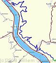
Track * Kaub to Lorch - and a bit further to our camping site. A high climb, getting into side-way valleys of Volkenbachtal and Schenkelbachtal (passing old mines and quarries), keeping more or less to the same height. A steep descent to Lorch, and from there, another 9 kilometres to the camping site, otherwise the walk would be too short. From the camping site, I cycled to Kaub to get he car. * 799 x 892 * (91KB)
Google-0901 * The route as seen on Google Earth; the numbers reflect location of the pictures, * 799 x 1124 * (321KB)
01-PfalzGrafenstein * The Pfaltz - a kind of fun castle, line a ship in the middle of the Rhine, bit now seen from the Kaub side. * 1984 x 1488 * (456KB)
02-BurgGutenfels * Burg Gutenfels - opposite a bend in the path. * 1984 x 1488 * (495KB)
03-AbandonedVineyard * Abandoned vineyard - like many in this area, too steep to be able to earn a living with viniculture. Often, the field is cleared, but this one was just left alone. * 1984 x 1488 * (675KB)
  Track  
  Google-0901  
  01-PfalzGrafenstein  
  02-BurgGutenfels  
  03-AbandonedVineyard  
04-LookingDown * Looking down on Kaub * 1984 x 1488 * (656KB)
05-WalledSlope * A newly erected wall along the slope below a previous mine to keep the path clear of stone.. * 1984 x 1488 * (625KB)
06-WhatHappensWithout * Otherwise, it would have looked like this. * 1686 x 1284 * (418KB)
07-Henschhausen * A look over the Hunsrück plateau, to the village of Henschhausen. * 1984 x 1488 * (488KB)
08-StoneWall * A wall of quartzite - a very hard type of stone, that has been quarries for ages in this area. * 1488 x 1984 * (735KB)
  04-LookingDown  
  05-WalledSlope  
  06-WhatHappensWithout  
  07-Henschhausen  
  08-StoneWall  
09-Schenkenbachtal * Descent into the Schenkenbachtal - getting lower to the stream below, starting fairly level but getting steeper in the end; Anyway it lead us back to the Rhine. * 1488 x 1984 * (405KB)
10-Qartsite * Another view of the hard Quartzite * 1984 x 1488 * (463KB)
11-OldMine-2 * An old mine aside the road. The shaft has been filled up to prevent accidents? * 1984 x 1488 * (494KB)
12-Niedertal-Path * In the Niedertal - the path bends in two directions: left, and down. Steeply down. * 1488 x 1984 * (658KB)
13-StateBorder * A mid-German border. We left Rheinland-Pfalz (where the forest is) and entered Hessen - this side of the sign). Nearby is the Granzhäuschen - the Border House - being restored. * 1488 x 1984 * (462KB)
  09-Schenkenbachtal  
  10-Qartsite  
  11-OldMine-2  
  12-Niedertal-Path  
  13-StateBorder  
$text.updated-on 23-Oct-2008 23:04
(c) 2008 Willem Grooters