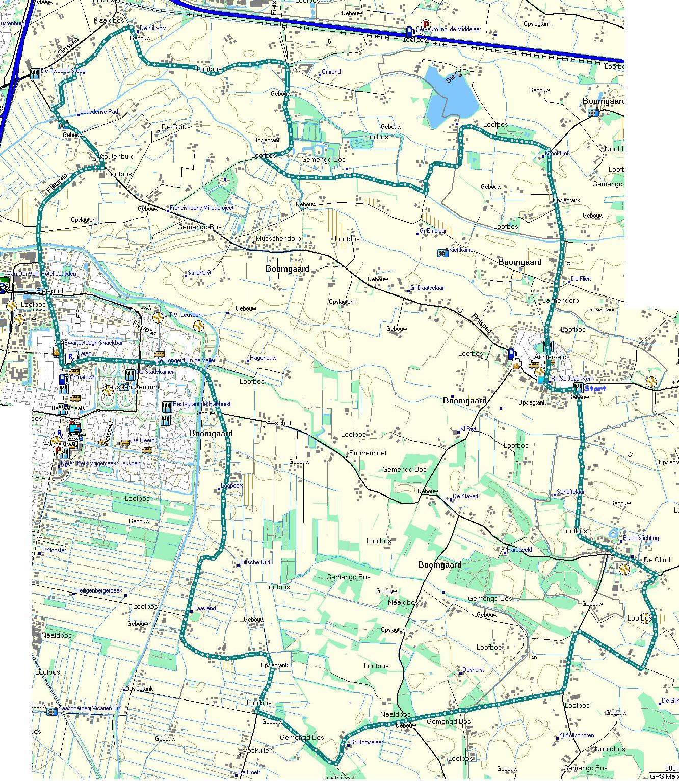
By bike, this time, but the same route can easily be walked – it’s about 25 kilometers. Not all roads are smooth. Some are no-paved, or in bad shape!
A new cycle path has been opened and we wanted to find out where it would lead us. A bit of a suprise, or disappointment, it turned out to be another route to Hoevelaken, at end, we went back to Stoutenburg and followed a path we walked some time ago. At that time, it meant finding our way over roots, but the path has been ‘upgraded’ to cycle track. At the end, we turned left in stead of right and took a longer route to Achterveld, from there over De Glind, in the direction of Scherpenzeel but bent back to Leusden – and because it was nice weather, it was foreseen the route along the canal would be crowded so we kept to the road.
On the map, start and finish are located in Achterveld, near the church. There are a few bars there, that can be used as a starting point.
You’ll find track (map and Google projection) , and tracks in Garmin, GPX and CSV format. No images this time, but you can get the map here