It’s an easy walk, about 15 kilometers: From home to a shop in Woudenberg to get wheat and flour for bread and cake. It is a fine day – not too warm, so I made this walk along the Valleikanaal, collected what I came for, and returned along the old railroad track.
Just images, no track: getting lost is too difficult on this one 🙂
Tag: Geldersche Vallei
Around Leusden (3)
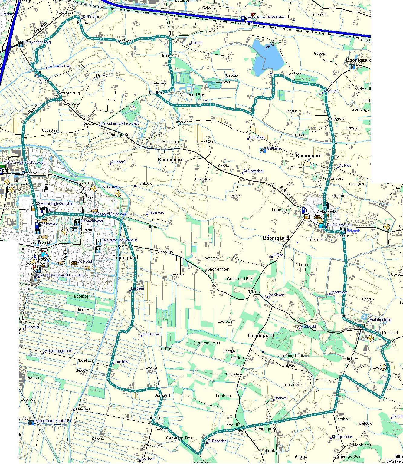
By bike, this time, but the same route can easily be walked – it’s about 25 kilometers. Not all roads are smooth. Some are no-paved, or in bad shape!
A new cycle path has been opened and we wanted to find out where it would lead us. A bit of a suprise, or disappointment, it turned out to be another route to Hoevelaken, at end, we went back to Stoutenburg and followed a path we walked some time ago. At that time, it meant finding our way over roots, but the path has been ‘upgraded’ to cycle track. At the end, we turned left in stead of right and took a longer route to Achterveld, from there over De Glind, in the direction of Scherpenzeel but bent back to Leusden – and because it was nice weather, it was foreseen the route along the canal would be crowded so we kept to the road.
On the map, start and finish are located in Achterveld, near the church. There are a few bars there, that can be used as a starting point.
You’ll find track (map and Google projection) , and tracks in Garmin, GPX and CSV format. No images this time, but you can get the map here
Up and down on the Utrechtse Heuvelrug
Starting out in a primary school in Veenendaal, today’s walk went into the woods – and on this area of the Utrechtse heuvelrug, it means going up and down. Not steep, but going up or down for a long time. The first and last few kilometers are over paved roads. Of course, you have to get through the outskitrs of Veenendaal, but once outside, you get on forest roads and paths through the woodland. The point for rest (and coffee) was on the high point at Kwintelooijen – about 50 meters over the Gelderse Vallei, looking out over Veenedaal, Ede and, in the distance, Wageningen. From here, we made a large loop over the Remmerden Forest – dogs not allowed: cattle greezing – and back to Kwintelooijen for a second rest, and the last part – downhill and into Veenendaal again.
The loop follows part of the Trekvogelpad between Amerongen and Rhenen – the part we didn’t do yet.
I took a few images, but tracked the whole route, downloadable in Garmin, GPX and CSV formats, as usual
Lunteren – Overwoud
Another two walks, set up by Tourist Offices in the area: Lunteren and Overwoud. These are two loops that share about 300 meters we didn’t do. We simply crossed the street after having coffee at “‘t Hek”.
The route crosses mainly the rural area of the ‘Gelders Vallei’, the low area between the high grounds of the Veluwe in the East, and the Utrechtse Heuvelrug in the West. It traverses the outskirts of the veluwe just before Lunteren.
This area is famous (for better of for worse) for the vast amount of pig-farms. A large amount of these farmers had thier livestock killed preventively on the pig’s pest outbreak a few years ago. Still, there are a lot of large pig farms, some even expand.
Some images are presented, as well as the track in Garmin, GXP and CSV format.
(The track has been published in the booklet “Boerenvalleiroutes – Wandelen in de Gelderse Vallei”, by Veluws Bureau voor Toerisme, RGV/A+T Veluwe, 1999. This booklet holds some background information of the area as well)
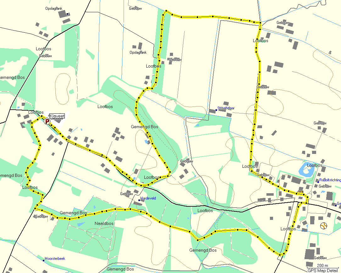
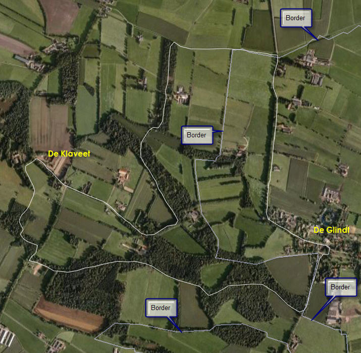
Klompenpad Achterveld
“Klompenpad” is the name given to local walks – most of them round trips of 5 to 10 kilometers, some are a bit longer. Most can be combined to longer walks.
This is one near the village of Achterveld. Parking is available near De Klaveet – a party center.
The tracks can be muddy at times – waterproof footwear is highly recommended in wet conditions.
Map and projection are available, as well as track data in Garmin, GXP and CSV dormats.
Around Leusden (1)
Last year, we walked from home to Achterveld – a village in the same parish – following smaller roads and a path along a stream. Back, we followed the normal road except for one detour, where we used a farmer’s road. All in all, the walk ia about 20 kilometers, and in wet conditions, the path along the stream can be very muddy and slippery. Waterproof and well profiles shoes are recommended.
The images can be found here. There are no other resources (at the moment)